
1. Investigate Data Properties
Overview of Spatial Reference Systems in the ArcGIS
In geospatial data, the spatial components of each feature are located using a mathematically defined coordinate system. The Earth is a three-dimensional object and utilizes an angle-based coordinate system. Map projection flattens the Earth’s round shape into two dimensions and presents locations in specific units, such as meters, kilometers, feet, or miles. This spatial information is stored in the GIS database as “Spatial Reference Systems.” Two frequent problematic issues in GIS data are 1) mismatched spatial reference systems when you are working with multiple GIS layers, and 2) no or insufficient spatial reference information.
ArcGIS has been developed to display data in different projections on the same page using the “projecting on the fly” mode. In other words, ArcGIS recognizes the distinct projections in your multiple datasets and attempts to temporarily convert the data projection. This prompt action sometimes works well if all data shares the same “datums” systems, but often does not perform smoothly.
Some of the data in this lab has no projected coordinate systems but has Geographic Coordinate Systems (GCS). As GCS stores the location of features in latitude and longitude using ellipsoidal coordinates, such as decimal degrees or degrees, minutes, and seconds, we cannot calculate areas or measure distances. In this lab, we will 1) examine the spatial reference systems in the data, 2) convert GCS to Projected Coordinate Systems (PCS), the flat planar systems, and 3) compare/contrast how the conterminous US area could be differently described by calculating the area of the conterminous US in each map projection.
Data Properties
1. Start ArcGIS Pro and create your Lab2 workspace.
2. Download Lab2_data.zip from Canvas and extract all into your Lab2 workspace.
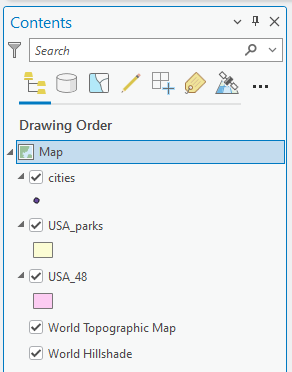
3. Add three vector layers in the usa_parks_cities.gdb:
Stop and think: You might see a warning message about the “Unknown Coordinate System.” What is this message for?
- Explain how ArcGIS Pro enables putting the GIS layers on the same “Map” view despite the difference in each layer’s coordinate systems.
- Even though the visual location looks “acceptable,” you should inspect the spatial reference of geospatial data before processing GIS analysis. Discuss the pitfalls of using multiple layers with different spatial reference systems for spatial analysis without coordinate conversion. Check the Spatial Reference of each layer. (Hint: Can you remember how we did it in Lab 1?)
Question 1 (0.5 pts.)
What is the name of the Coordinate system of the three feature classes? If the layer was “projected,” include the Projected Coordinate System for your answer as well.
- cities
- USA_48
- USA_parks
- World Topographic Map
4. Remove the “cities” and the “USA_parks” layers, as you do not use these in the next step.