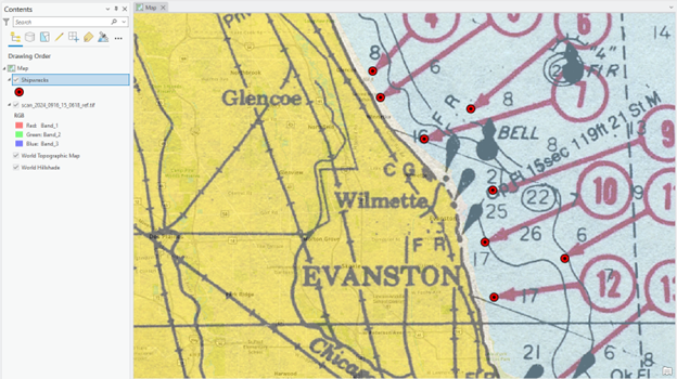
1. Creat points
1. Create your Lab 4 workspace, e.g., Lab04, and add a scanned map, “scan_2024_0916_15_0618_ref.tif.
2. Click Raster Layer on the Ribbon, and adjust the scanned map’s Transparency to 50%
We will create a “Point” vector layer from the scanned map first.
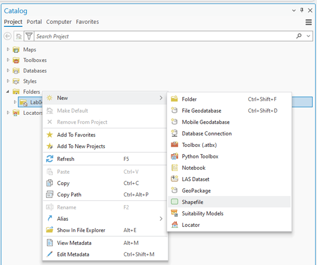
3. In the Catalog pane, expand Folders and find your Lab04 folder:

4. Right-click the Lab04 workspace folder, click New, and choose Shapefile:
5. The Create Feature Class tool appears in the Geoprocessing tab. Fill in the parameters, focusing on
-
- Feature Class Name: Shipwrecks
- Geometry Type: Change from default “Polygon” to “Point”
- Coordinate System: Click the dropdown icon and choose scan_2024_0916_14_0618.tif. Then, “WGS 1984 Web Mercator Auxiliary Sphere” will appear, as it’s the spatial reference of the scanned maps.
6. Click Run. You can find “Shipwrecks” in the Contents pane.
The Shipwrecks point vector is currently an “empty” file since we have not inserted anything in it yet; please open the attribute table of the Shipwrecks layer to confirm its emptiness:
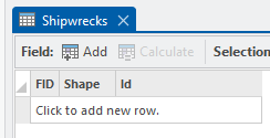
We will use the Edit tool to create a digital format of the shipwreck location in the scanned map.
7. On the Edit tab in the Ribbon, click Create. Then click the Shipwrecks in the Create Features tab and choose the Point:
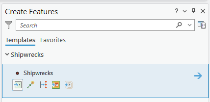
8. Find and click the first shipwreck point. You can find a small “cyan” colored dot at the location that you clicked:
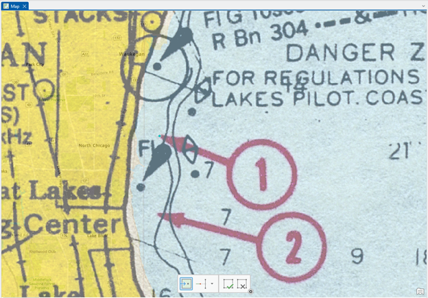
8. Click the Save button in the Edit tab occasionally for the digitizing process.
9. Complete digitizing of all the shipwreck points.
10. Change the point symbology to present it as an accident location. You can select any symbol that you want – here is an example:
