
3. Define spatial reference
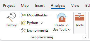
At the beginning of this lab, one of the vector layers does not have a spatial reference, so you get a warning message, “Unknown Coordinate System.” We will provide the spatial reference in the missing spatial information layer with Geoprocessing Tools in ArcGIS Pro. Geoprocessing is for data management and spatial analysis in ArcGIS Pro. It contains many tools that enable specialized operations, also known as “geoprocessing” tasks. To start Geoprocessing, click the Tools in the Analysis tab in the ribbon:
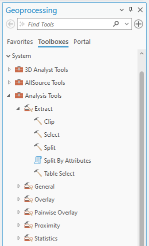
Usually, when it first appears on the ArcGIS Pro, it pops up with the Favorites option. Click Toolboxes to look through the methods provided by ArcGIS. Geoprocessing is organized as a hierarchy. By expanding each “Tool,” we can find the tools available under the toolbox. Here is an example of an Analysis Tools:
Now, we are ready to use the “Projection” tool in Geoprocessing to define the layer’s spatial reference systems.
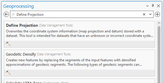
1. Let’s search for the Projection tool in the Geoprocessing. Type Define Projection in the blank box in the Geoprocessing:
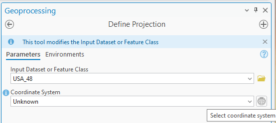
2. Click the drop-down icon in the Input Dataset or feature Class and choose USA_48. The Coordinate System shows Unknown. Click the “globe” icon:
3. The Coordinate System window pops up. Expand “Geographic Coordinate System”
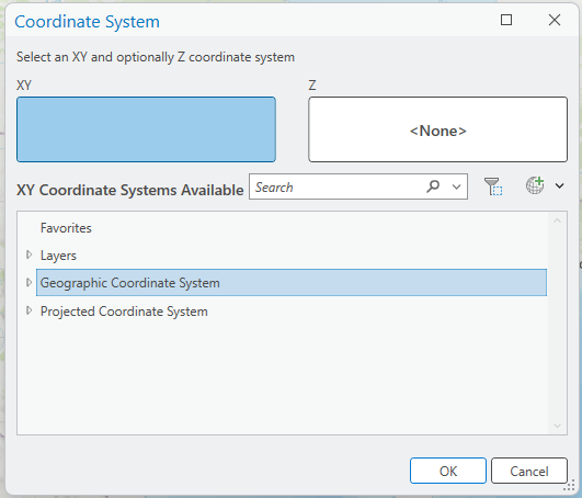
In-Class Discussion (1 pt.)
Many Geographic Coordinate Systems (GCS) are available in ArcGIS Pro. Which one should we choose in this lab and why?
4. Select a GCS based on the In-Class Discussion and click Run in the Define Projection tool.
Now, the USA_48 layer has a proper Geographic Coordinate System. Please confirm that without the “Define Projection” procedure, you will not be able to proceed and complete the rest of the lab.
Stop and Check: Please remember to save your ArcGIS Pro project frequently to keep your work safe and secure.