2. Process Vector: Dissolve
Let’s begin the “Process Vector” section with a question, continuing to use the “NLCD2024_polygon” layer.
Question 1 (0.5 pts.)
Open the attribute table of NLCD2024_polygon. How many rows does it have?
As we can see, there are multiple polygons of the same LULC. After reviewing the information in the attribute table, however, I am questioning the purpose of so many rows of the table with redundant information. This table also occupies storage space on my computer, resulting in slower processing times! Considering the purpose of this geoprocessing, estimating the land cover status in Monroe County, do we need all the tiny segmentations of polygons? The answer is “NO!”
The Dissolve is a one-layer vector processing tool that combines multiple features into a single polygon based on specified attributes. In this case, we will dissolve the NLCD2024_polygon with land cover types.
1. In the Geoprocessing, search Dissolve and fill in the parameters like:
-
- Input Features: NLCD2024_polygon
- Output Feature Class: NLCD2024_polygon_Dissolve
- Dissolve Fields: ClassName
- Click Run
Question 2 (0.5 pts.)
Open the attribute table of NLCD2024_polygon_Dissolve. How many rows does it have?
2. Right-click the NLCD2024_polygon_Dissolve, open Symbology, choose Unique Values in Primary symbology, and click Add all values:
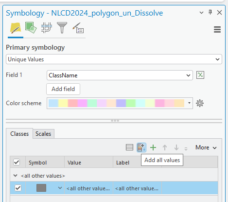
3. Choose the Color scheme that fits your preference.
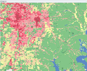
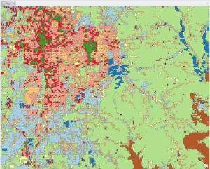
Stop and inspect: Explore the dissolved NLCD2024 polygon and compare it with the original raster format NLCD image file. Find the difference between the raster and vector formats of LULC. Here is an example: