
29 Campo Cerrado
The Campo Cerrado is Brazil’s second-largest biome (700,000 square miles) after the Tropical Rainforest. Little attention has been paid to this unique dry season landscape, being overshadowed by the importance of its globally significant neighboring rainforest. The direct translation from Portuguese is “closed field”.
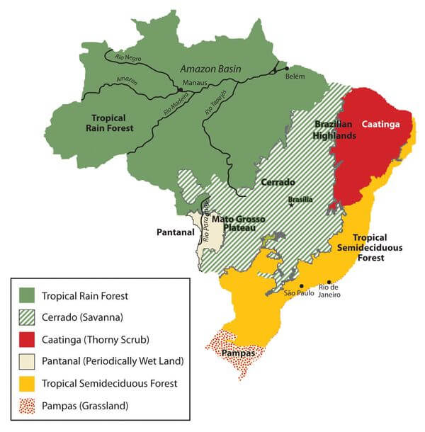
The Campo Cerrado biome, shown with diagonal green lines on the Map from LAC GEO, is classified as a Savanna because of the dominance of grasses over trees and the presence of a dry season. Located on the Brazilian Plateau, a large landmass, that drifted away from Pangea, the ancient super continent of the Carboniferous geologic period, approximately 300 million years ago.
The Campo Cerrado is classified as a tropical savanna because it contains two, six-month seasons: dry and rainy. Nestled beside the Amazon Rainforest, the aridity becomes more pronounced with the sandy soils on the Brazilian Plateau.
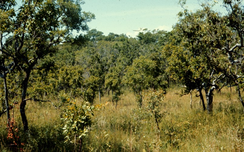

Rainy and dry season Campo Cerrado. The green rainy season vegetation contrasts with the dull green of the dry season. Photos by Rick Bein 1971.
The savannas around the world each develop a character of their own, having developed ecologically in isolation. The Brazilian Campo Cerrado is composed of a fire edaphic scrub forest mixed with its dominant grasses. From first glance it might be labeled a forest because of the appearance of the short shrub-like trees.
Globally, in savanna lands, fire plays a significant role in its ecology, so much so, that the vegetation is dependent on periodic burning. The Brazilian example is mentioned here. The dominant lixeira (Portuguese for trash tree) seeds will not germinate until experiencing a fire. The seeds may remain on the surface, dormant, for years until fire makes its mark. The Jatoba (Hymenaea stigonocarpa} tree sheds seed pods that resist fires. Usually, fires come during the dry season when the natural vegetation is more stressed. The lixeira tree (curratela americano) trees can reach up to twenty feet.
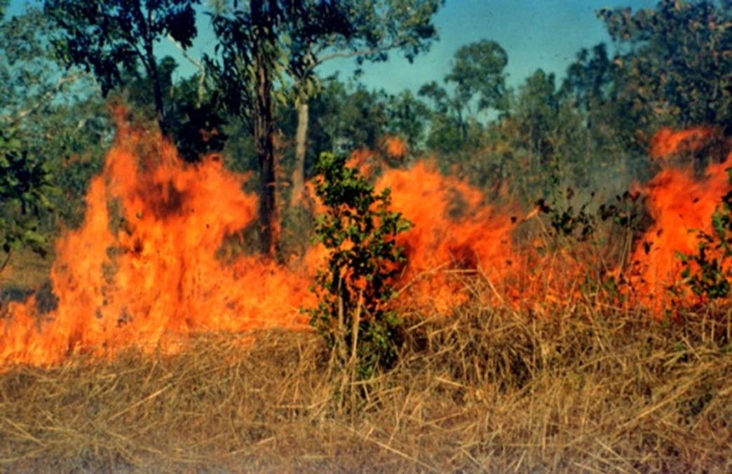
Fire is part of the Campo Cerrado ecology. Note that the fire is mostly a ground fire. The right side of road has been burned, but the vegetation is not dead. The road serves as a firebreak. Note the sandy soils, typical of the Brazilian Plateau. Photos by Rick Bein 1971.
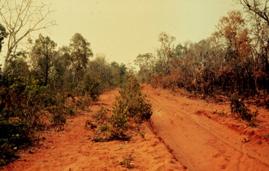
Another factor that limits the Campo Cerrado is that is lies on the ancient deep sandy soils that have developed on the Brazilian Plateau, geologically a part of the Pangia super continent of the Carboniferous geologic period, approximately 335 million years ago. Because of the deep nature of these soils, the neighboring tropical rainforest trees with their shallow roots cannot survive. The deep-rooted Campo Cerrado vegetation endemic to the Brazilian Plateau grows more luxuriantly with higher rainfall, the vegetation is coherent with rest of the Cerrado biome. This does impact the biodiversity of this part of the Campo Cerrado as most of the plant species are the same.
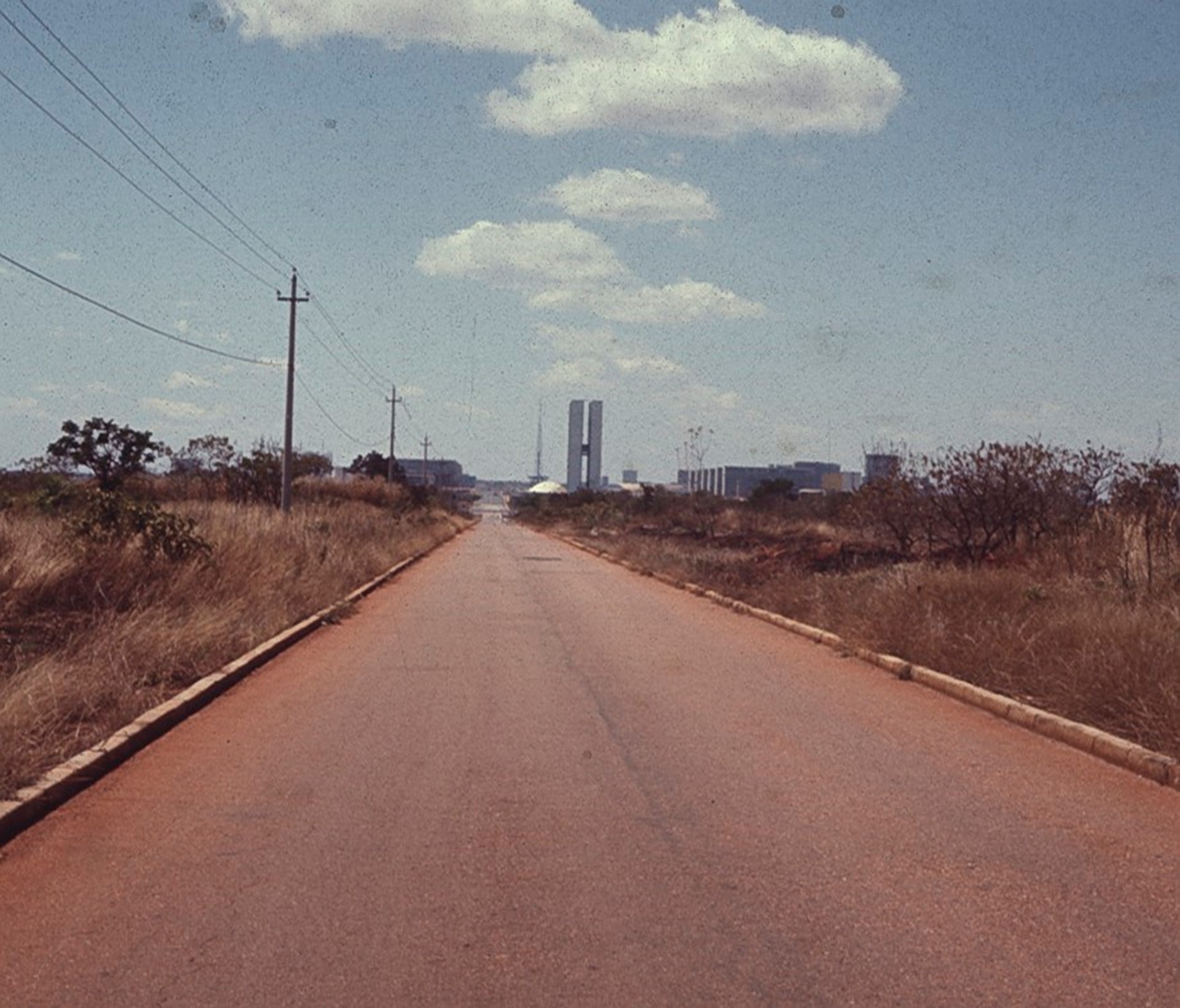 When the Brazilian Government decided to construct Brasilia as its new capitol this empty Campo Cerrado land was available. I took this photo in 1971 during the construction.
Local people define the more luxuriant Campo Cerrado as Cerradao. They also define the dryer Campo Cerrado as Campo Sujo. Terra Preta is their label when it occurs on the occasional dark organic soils. Campo Limpo defines area with few to no trees. There are various home remedies which are served as tea from bark, leaves, or grass to treat diuretic conditions and maladies of the bladder, kidneys and coughs.
I actually lived in the Cerrado region in the mid 1960’s while working in the Brazilian Peace Corps in Mato Grosso do Sul. Again in 1971, on a research grant I drove my Volkswagen into deep sand and became entrenched. Mary and I had a somewhat terror filled moment of being stranded in the middle of the South American continent. There was no hope of anyone else coming by, so we began walking. After 10 miles we came to the small town of Camapua. Relieved, we found a boarding house for the night, and the next day proceeded by bus to the main city of Campo Grande. A few days later I found a driver with a tow truck to drive out to the abandoned vehicle and pull it out.

This deep sandy soil was too much for this vehicle. Photo by Mary Bein 1971.
The old farmers of the area considered the Campo Cerrado as waste land that could not be farmed. The Campo Cerrado is quite acidic with a pH of 4.9 on a scale of 14. In actuality, the Campo Cerrado can be farmed with applications of lime and fertilizers. These farmers had no access to these materials.
The potential as farmland was discovered in the 1980s when mechanized soybean farming became successful. Today vast areas of the Campo Cerrado are being farmed with inputs of chemical fertilizers. Over half the Campo Cerrado has been converted to soybeans. Some concern has arisen that this unique biome will be destroyed. However, the concern for the Tropical Rainforest overshadows any concerns for the Campo Cerrado.
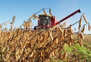
Until recently the Campo Cerrado was considered a waste land because of the difficulty in farming the deep sandy sterile soils. It was not until the 1980s that major capital investment farms turned this land into the world’s largest soybean producer in the world. With high levels of fertilizer and irrigation water from a previously unknown aquifer, soybeans thrive. Images from Brownfield Ag news
Soybeans in Mato Grosso Brazil. Photo from brasil agro.com.br.

A Modern central pivot irrigation makes it possible to grow soybeans in the dry season. With two harvests per year, Brazil has become the leading producer of Soybeans in the world. Photo from Brownfield News.

The green areas on the 2022 map show where soil beans are being grown. Most of the Campo Cerrado land is included.
